FastFood Global
FastFlood is a super-fast flood model that lets you see potential flood maps almost instantly. It's designed to be interactive and easy to use, so you don't need to be a flood modeling expert to explore different scenarios.
 \
\
A Closer Look at FastFlood Global
FastFlood Global is a breakthrough tool that allows anyone, from local authorities to citizens, to simulate floods anywhere on Earth within seconds. Building on the original FastFlood model developed at the University of Twente, it transforms what was once a more complex, technical process into a simple, intuitive experience.
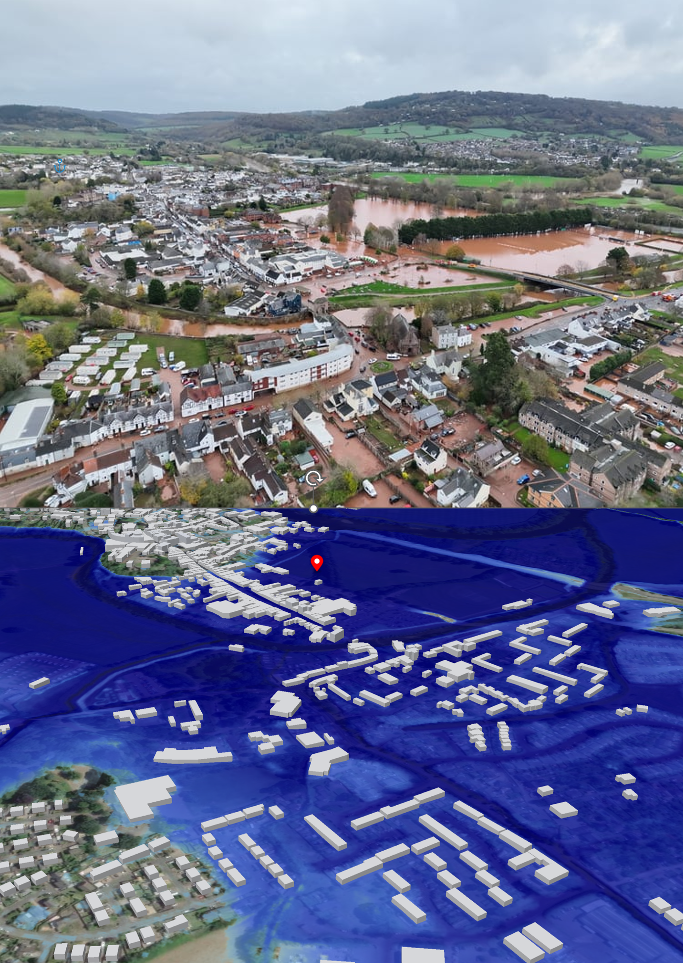
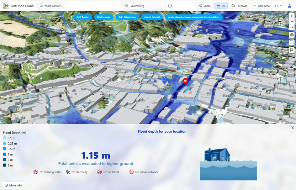
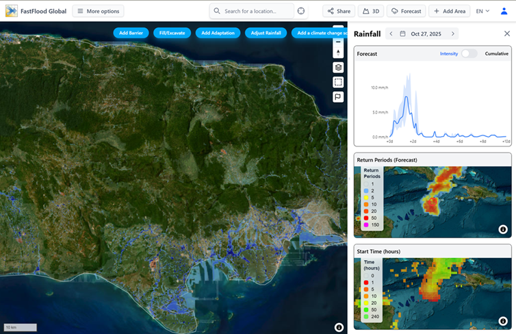
With FastFlood Global, users can type in an address or place name, choose between moderate or extreme rainfall scenarios, or use real forecast data, and within seconds view how flood water would move through streets, valleys, or cities. The results appear as detailed flood maps showing water will collect, how deep it could be, and which areas are most at risk.
The power of FastFlood Global lies in it’s speed, accuracy, and accessibility. Thanks to years of research and significant advances in computing methods, the model runs up to 20,000 times faster than conventional flood models while still producing highly realistic results. It automatically selects globally available elevation, rainfall, and land-use data; meaning no local datasets, special training, or installations are required. Everything runs directly in the web browser.
This accessibility makes flood forecasting and climate-risk planning available to a much wider audience. Emergency responders can explore “what-if” scenarios during a storm. Urban planners can test how a new park or dike might reduce risk. Citizens can see how their own neighborhood could be affected by predicted storms and prepare accordingly.
In short, FastFlood Global puts flood insight into everyone’s hands, no matter where on Earth; fast, visual, understandable, and interactive.
What Type of Model is FastFlood Global?
FastFlood Global is different. It was designed from the ground up to make flood modelling fast, intuitive, and accessible to all users.
FastFlood's innovative peak intensity approach is a physically-based method that achieves revolutionary speed by directly computing the final peak flood depths, peak velocities, and durations. This is accomplished through advanced steps like logarithmically cascaded profile approximations. To ensure high hydraulic accuracy, this initial distribution is then refined by a full hydraulics solver, specifically a "cascaded grid adaptive saint-Venant solver". This final step ensures the resulting flood map is not just fast but also precise, delivering exceptional accuracy demonstrated in real-world events.
The model's peak-calculating nature is key to its efficiency. Unlike traditional models that must simulate a flood's progression through thousands of tiny increments—a slow process called time-step based numerical integration of partial differential equations FastFlood's engine is different. It still accounts for time-based factors (like the flood wave and storage), but its advanced algorithms solve for the peak conditions directly, as well as their duration and dynamics. In essence, it calculates the final answer—the peak depth, velocity, and arrival time—without needing to simulate every intermediate second, allowing it to produce a complete, high-resolution flood map in seconds rather than hours.
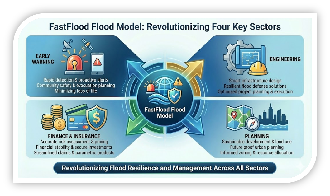
Finance – Immediate Insights into risk and losses
Access to detailed flood info without expert involvement, apply the tooling quickly at any location to verify past and future risk.
Engineering – Visualize your scenario instantly
Save time and money with instant model setup and result, with all the same control and customization you are used to.
Warning – Ground-breaking detail for any location
Groundbreaking flood forecasting information, for both fluvial and flash flood events anywhere on earth.
Planning – You are at the steering wheel
Put planners in the driving seat, and allow them so see directly how their ambitious plans interact with water resources.
Several improvements have been made compared to the original FastFlood application. Improved global datasets, developed in-house with global coverage, as well as integration of high-detail national datasets in a seamless manner.
- Global Coverage: The original FastFlood worked well globally, but benefitted from local dataset additions, especially for data-sparse locations or the incorporation of rain forecasts. FastFlood Global now works anywhere on Earth, from rural countrysides to downtown in the largest cities, with the same ease and reliability
- Built-in data: There’s no need to collect of prepare data yourself now. The system automatically draws from global sources for elevation, rainfall, and land use.
- Simplified workflow: Instead of technical inputs of file uploads, users can simply enter an address, choose rainfall conditions, and press simulate
- Massive speed increase: Thanks to new techniques and optimized algorithms, FastFlood Global is up to 20,000 times faster than traditional models. An improvement from FastFlood Technical is that Global performs quickly even with larger model areas.
- Interactive Exploration: Users can test real-world actions, such as planting trees, adding flood walls, or changing land use, and instantly see how the flood response changes.
- Enhanced visuals and reporting: This tool provides clear, high-resolution maps that can be shared in reports, presentations, or early-warning dashboards.
These improvements make flood simulations not just faster, but practical for everyday decision-making. From government agencies to schools and NGOs, anyone can now explore flood risk interactively and learn by doing, without technical barriers.