Adaptations
Interactive Adaptation (Testing Your Solutions)
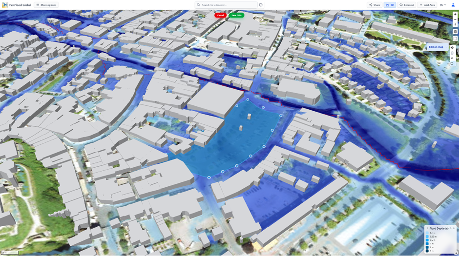
This is where FastFlood Global truly shines. You can test mitigation ideas in real-time and see if they work.
- Load Your Scenario: Open the 100-year storm you just created in Chapter 2. Note the areas that are badly flooded.
- Use the Adaptation Tools: On the top bar, you'll find simple drawing tools.
- ** Add Barrier:** Click this and draw a line on the map where you want to build a levee or flood wall.
- ** Fill/Excavation:** Click this and draw a polygon to create a retention pond (storage area) or to deepen a river channel.
- Save Edits: When you finish drawing, click "Save Edits".
- See the Change Instantly: The platform re-runs the simulation in seconds. Your new flood map will appear, showing you exactly how much your barrier or pond reduced the flooding. You can keep editing and re-running to find the best solution.
Green and Gray Adaptions
Adaptation solutions to limit flood impact are sometimes categorized in Green and Gray solutions. Preferring nature-based solutions (green) over traditional infrastructure (Gray) can generate better benefits to environment and public health, though often a combination can work best in terms of cost-benefit balance.
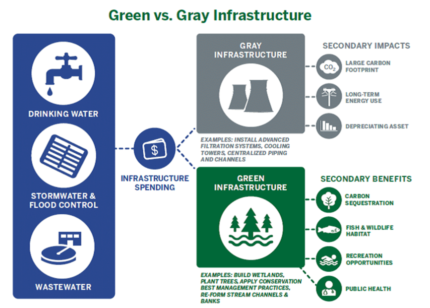
FastFlood integrates several types of gray and green solutions by default, and can be easily selected from the adaptations editor.

❓ Questions & Answers
- When I use the "Add Barrier" or "Fill/Excavation" tools, what am I technically changing in the model?
- Answer: You are directly editing the model's primary input data: the Digital Elevation Model (DEM). The "Add Barrier" tool "paints" positive elevation values (e.g., +5 meters) onto the map, while "Excavation" paints negative values. The model then re-runs the entire simulation from scratch using this new, modified terrain map.
- How reliable is a simulation showing a deepened channel? Does a good model result guarantee it will work in the real world?
- Answer: No. The model provides a reliable hydraulic result, showing how water would flow in that new, larger channel. However, the model does not simulate sediment transport, and might use limited accuracy data. In a real-world event (like a hurricane), landslides might wash tons of sediment into the river, completely filling your newly-excavated channel and making the mitigation measure useless. The model result is a powerful tool, but it must be interpreted with real-world engineering and geological knowledge