Introduction
FastFlood – Overview
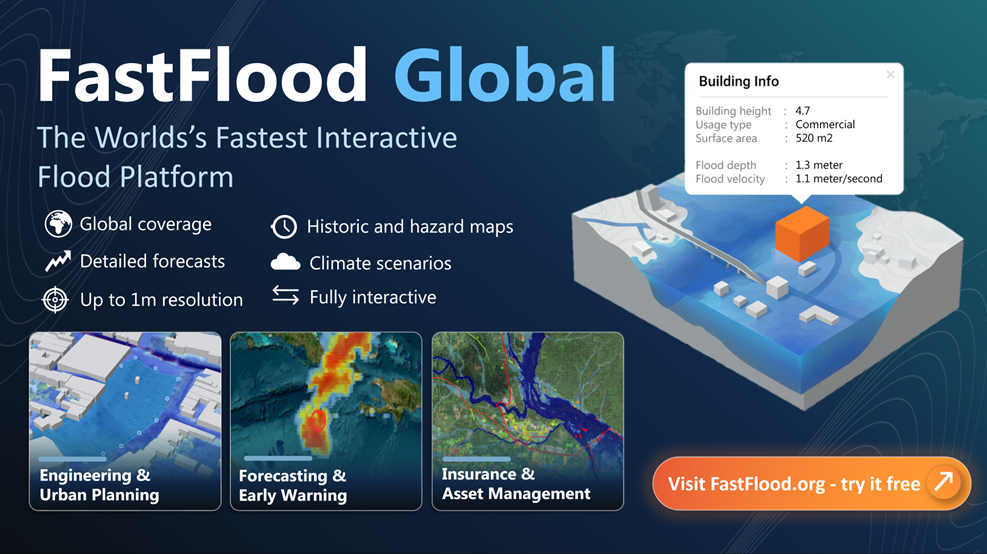
FastFlood is a browser-based flood simulation platform designed to allow users to run high‑resolution flood simulations anywhere in the world within seconds. The system automatically integrates global datasets such as elevation models, precipitation data, land‑cover information, and soil data.
There is
FastFlood Technical - A technical browser based tool for customized setup.
FastFlood Global - A detailed information and modelling platform benefitting from automated setup anywhere on earth.
The platform is designed to be:
- Extremely fast
- Interactive
- Globally available
- Easy to use without specialist modelling knowledge
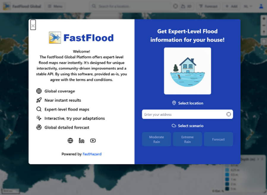
The simulation workflow is simple:
- Enter a location
- Select a rainfall scenario or forecast
- Run the simulation
- View flood maps and impacts
Key Features
- Global flood modelling coverage
- High resolution simulations (up to ~1m in some regions)
- Instant simulations using cascaded grid algorithms
- Interactive adaptation testing
- Built‑in global datasets
See also
Our youtube channel - https://www.youtube.com/@fastflood
Or our linked in - https://nl.linkedin.com/company/fast-hazard-b-v
Or contact us at - https://www.fasthazard.com/contact/
How the Model Works
The FastFlood model uses a Peak‑of‑Threat approach, which calculates the peak flood depth, velocity, and arrival time without explicitly simulating every time step of the event.
Instead of integrating full time‑dependent hydraulic equations for every step, FastFlood: 1. Performs hydrological routing 2. Computes inundation hydraulically using an adapted Saint‑Venant solver
This allows simulations that normally take hours to complete in seconds.
Typical Applications
- Early warning flood forecasts
- Engineering feasibility studies
- Insurance risk modelling
- Urban planning
- Climate adaptation scenario testing
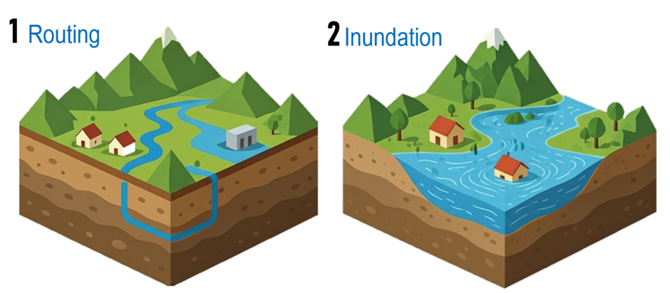
Two Main Steps: Routing and Inundation
The model first figures out how water moves through rivers and reservoirs in a process called routing. Then, it calculates how that water spreads out over the surrounding land to create the final flood map, a step known as inundation mapping.
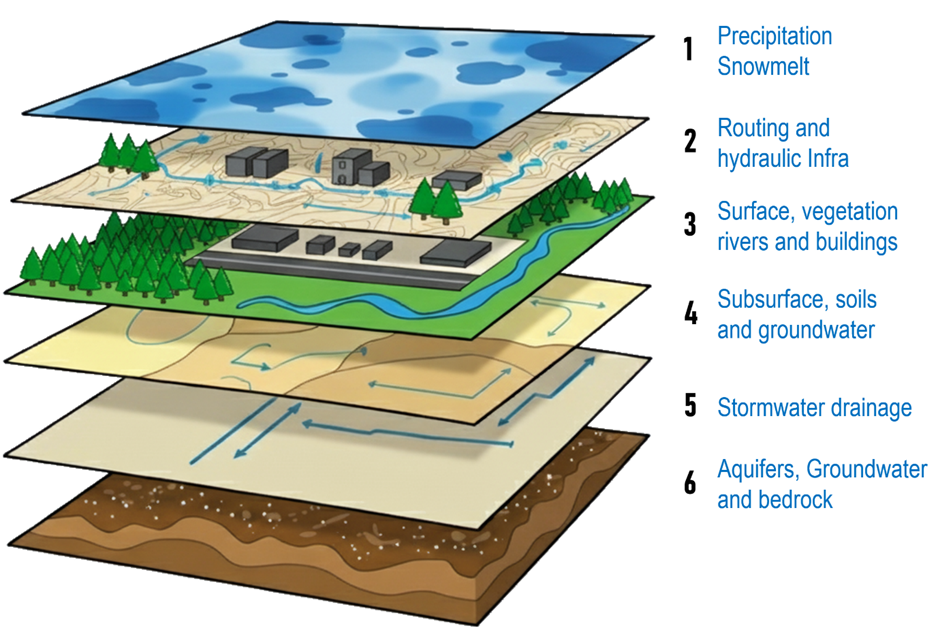
Data Layers
To make accurate maps, the model uses many layers of global data. These include detailed elevation maps to know the shape of the land, land cover data to know where forests, cities, and farms are , and soil information to understand how water soaks into the ground.
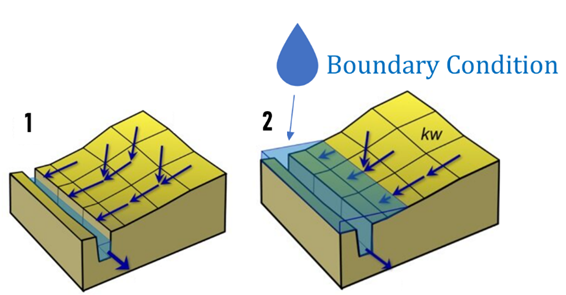
Boundary Conditions
Boundary conditions tell the model how much water is flowing into the area from rivers at its edges. This is a crucial starting point, ensuring the simulation begins with the correct amount of water in the river system.
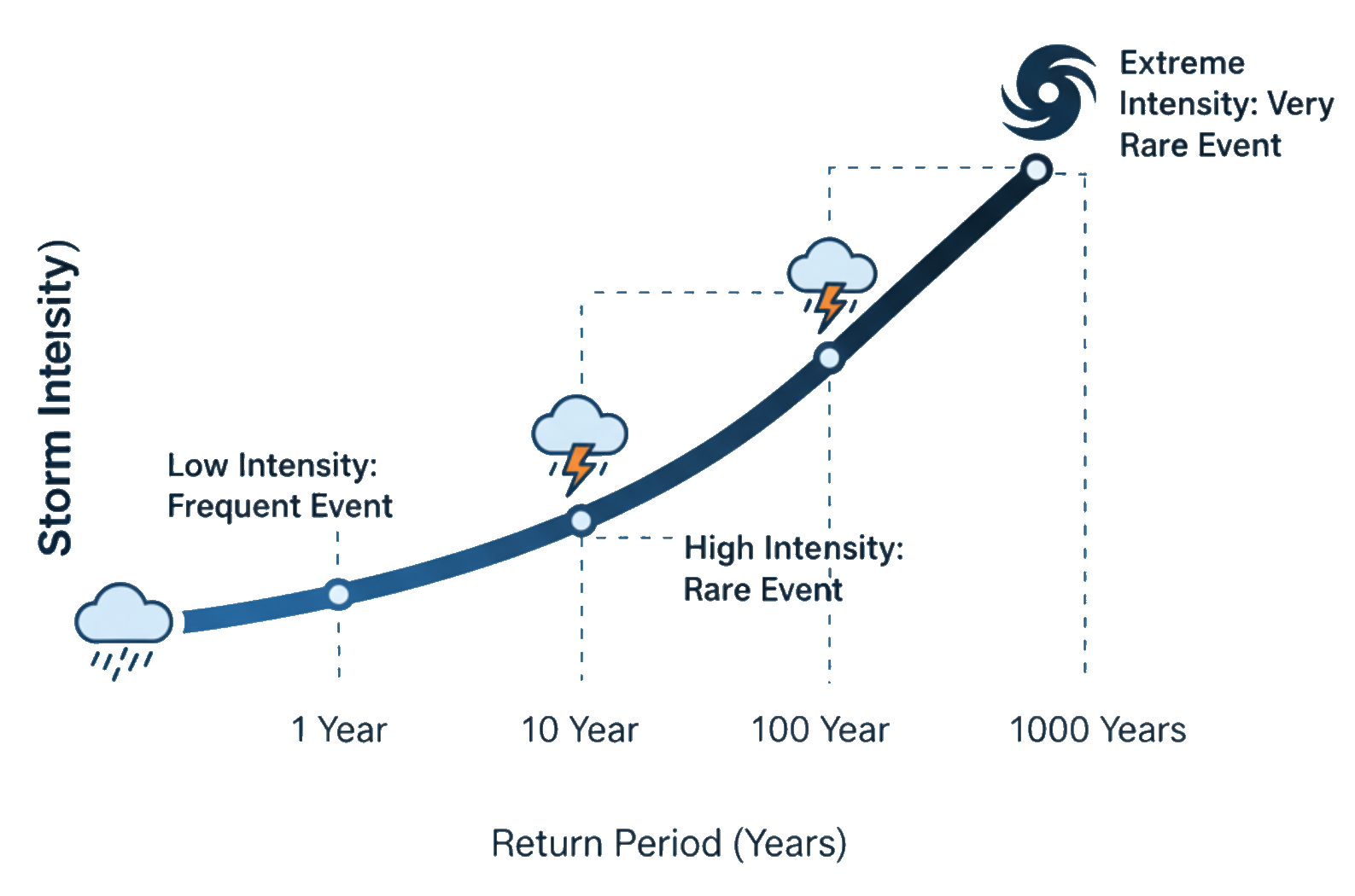
Design Storms & Return Periods
You can test how an area would handle different types of floods by using "design events". These are often described by a "return period," like a 1-in-100-year storm, which represents a very intense storm that has a 1% chance of happening in any given year.
Questions & Answers
Q1: What makes FastFlood Global faster than traditional flood models?
Answer: FastFlood computes peak flood conditions directly using a cascaded grid hydraulic solver rather than simulating thousands of time steps.
Q2: Do users need to prepare input datasets before running a simulation?
Answer: No. The platform automatically downloads and processes elevation, rainfall, and land‑cover data.
Q3: Who can use FastFlood Global?
Answer: Anyone from emergency responders and engineers to citizens who want to understand flood risk.